Jun 8, 2026
The NROC Habitat Classification and Ocean Mapping Subcommittee (HCOM), in partnership with the NOAA Office for Coastal Management, and other entities have collaborated to update a regional seafloor geomorphology dataset using a repeatable workflow and methodology.
The dataset, called “Seascapes” was first released in late 2023. This new version, called “Seascapes II”, integrates newer source data and a workflow refined by NROC HCOM and Inspire Environmental.
Seascapes II layers can be found in the Data Explorer under Bathymetry & Seafloor > Seafloor Features & Geoforms.
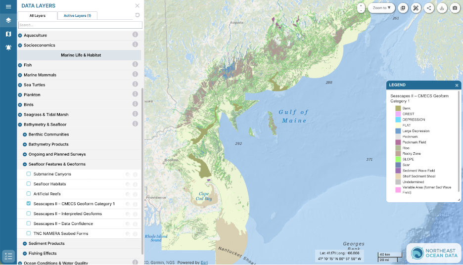
Seascapes products are Coastal and Marine Ecological Classification Standard (CMECS) – compliant geoforms derived from the seamless Blue Topo data from NOAA’s Office of Coast Survey. Portal users can overlay the Seascapes data with the Blue Topo layer by selecting it in the Data Explorer under Bathymetry Products.
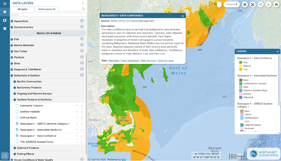
The maps show different bottom types, such as rocky areas, shoals, and moraines. CMECS is a structured catalog of ecological terms that also provides a framework for interpreting, classifying, and inter-relating observational data from all types of sensors and platforms. CMECS Geoforms describe the major geomorphic and structural characteristics of the coast and seafloor. A new Data Confidence layer that essentially reflects the age of the source datasets used to derive seafloor features can be overlaid with the features to aid in interpretation of the Seascapes II data. The Data Confidence layer can also be used to prioritize areas for new high-resolution seafloor data collection.
The Seascapes map products show how interrelating seafloor components and habitat areas across the region are distributed. In addition to providing a general understanding of the region’s benthic habitat, Seascapes can be used to understand where known sensitive habitat areas exist that could trigger extra precautions during project construction and operation or that may need to be avoided, which may assist the public and permitting organizations understand potential impacts of proposed projects. NROC HCOM and the partners who produced Seascapes I and II are working on extending the methodology further south.