

Apr 8, 2026
In collaboration with the Northeast Regional Ocean Council (NROC) Coastal Vegetation Workgroup, the Northeast Ocean Data Portal has released a suite of updated and new data layers for seagrass habitats across the region. This effort, supported by multiple data sources, was driven by the need to improve the consistency, accuracy, and utility of coastal habitat data for ocean planning, management, and assessment.
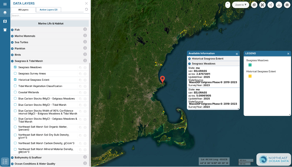
The Portal’s regional composite eelgrass layer, first developed in 2014, has been updated. To better reflect the diversity of mapped species, the workgroup renamed the layer “Seagrass Meadows”. This updated layer now includes information about the program that mapped each meadow and the year of the survey, and accounts for the presence of both eelgrass (Zostera marina) and widgeon grass (Ruppia maritima) where mapped.

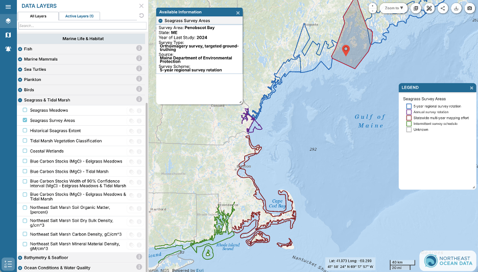
To help users interpret patterns of seagrass presence and absence, the Coastal Vegetation Workgroup developed a “Seagrass Survey Areas” layer. This layer illustrates the footprint and frequency of seagrass surveys across New England, highlighting how different states approach monitoring. For instance, Maine and Massachusetts have divided their coastlines into zones that are surveyed on a rotating basis, while other states aim to survey their entire coastline every few years.
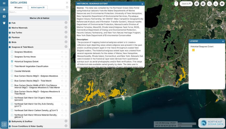
Complementing these, the “Historical Seagrass Extent” layer was also updated. This layer compiles data from quantitative surveys (e.g., aerial photography, field verification) to show areas where seagrass was historically present. This layer should be used to understand where eelgrass was present in the past and/or could be present again in the future throughout coastal New England waters.
Accessing the Data
In the Data Explorer, you can find these layers under Marine Life & Habitat > Seagrass & Tidal Marsh. For each layer, click the grey “i” to open a popup containing more information, including a metadata link to access detailed reports on data sources, processing methods, important data use limitations, and a link to download data directly.
Accessing Additional Information about Seagrasses & Tidal Marshes
Finally, the Workgroup compiled a list of seagrass and tidal marsh data sources and collaborative groups across the northeast to be included in the Portal as a resource for users needing more information or assistance with data and trend interpretation. The groups are listed on the Seagrass & Tidal Marsh topic page and should be referenced for uses that involve understanding the environmental context of a particular coastal vegetation habitat or location. The groups and experts listed on this page have deep knowledge and experience of the coastal vegetation habitats in their region and are willing to assist data users.