

Oct 1, 2026
The NROC Tribal Caucus sought to centralize information about river herring and shad runs in New England to support scientific understanding and inform decision-making about protection and restoration of diadromous fish habitats and populations.
The new River Herring and Shad Runs layer provides point locations of fish runs throughout the Northeastern U.S. with links to additional information on managing entities and fish counts. The data were aggregated from a number of sources, including the Massachusetts Division of Marine Fisheries, the Peconic Estuary Partnership, and the ECOFish Shad and River Herring Run Data Portal (created by the Gulf of Maine River Herring Network and the Mid-Atlantic Fishery Management Council, hosted by Manomet).
To access the River Herring and Shad Runs layer, navigate to Fish > Diadromous Fish Runs.

Data Provider(s):
- Association to Preserve Cape Cod
- Atlantic States Marine Fisheries Commission
- Buzzards Bay National Estuary Program
- Connecticut River Salmon Association
- Gulf of Maine River Herring Network
- Maine Coast Heritage Trust
- Maine Division of Marine Fisheries
- Maine Rivers
- Massachusetts Division of Marine Fisheries
- Peconic Estuary Partnership
- Rhode Island Department of Environmental Management
- Save the Sound
- U.S. Manomet Conservation Sciences
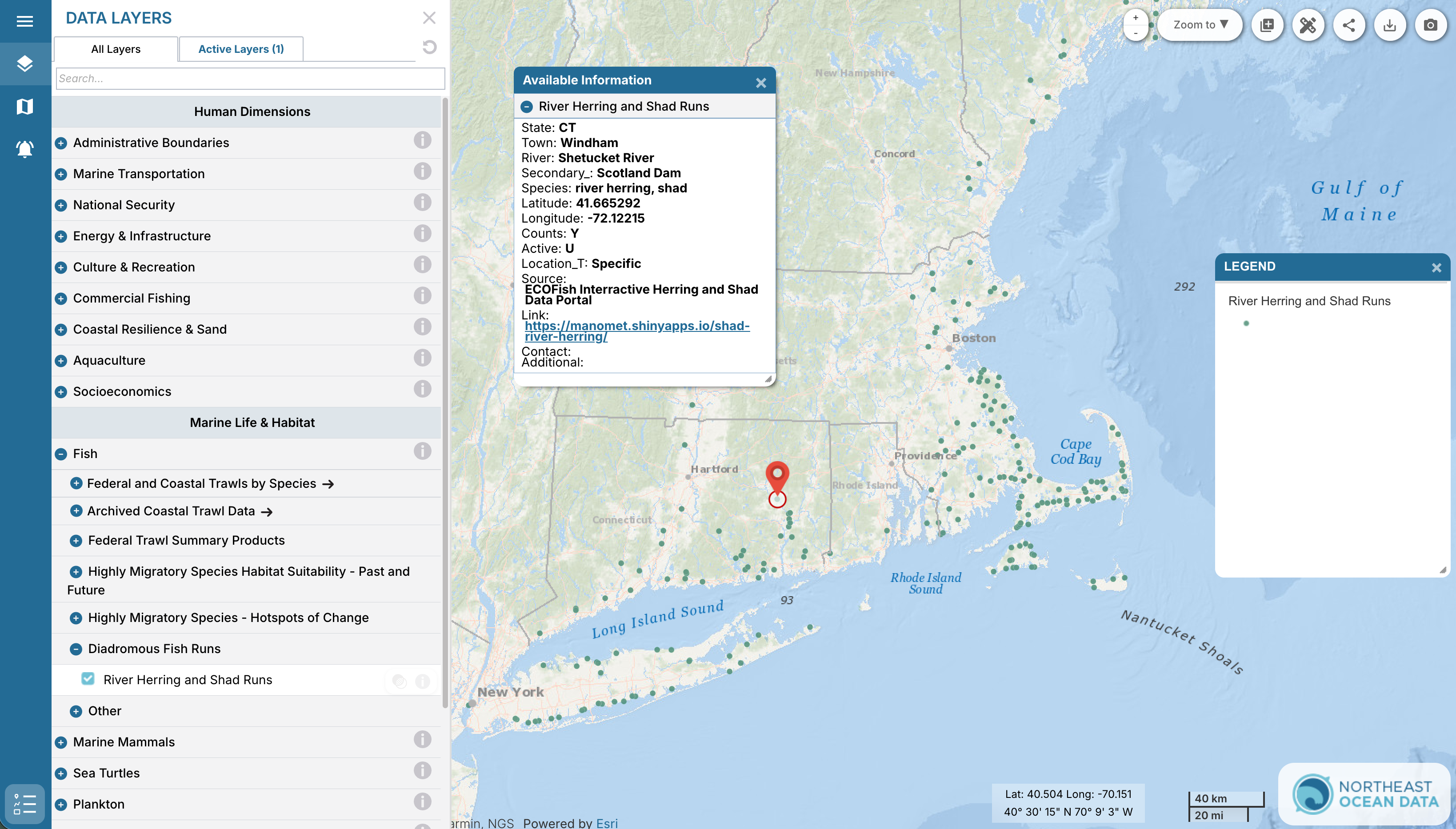
River herring and shad, which migrate between river and ocean habitats as part of their lifecycle, are culturally, ecologically, and commercially important species with declining population numbers along the east coast. Populations have been declining for many years due to habitat loss, barriers to upstream habitat (e.g., dams, culverts) and bycatch in the Atlantic herring fishery, prompting numerous initiatives to assess river herring populations and to restore and protect their habitat. Many of these challenges are shared by other diadromous species in the Northeast U.S., though conservation and population assessment initiatives vary by species. The NROC Tribal Caucus is interested in expanding the River Herring and Shad Runs layer to include runs for other species in the future.
Fish runs are the specific migratory pathways that diadromous fish take to complete components of their lifecycle. In New England, many state governments, non-profit organizations, and community science groups conduct surveys of fish runs to document their location and/or assess fish population size. Runs for river herring and shad represent pathways that these fish take as they migrate from the open ocean to lay eggs in freshwater.
The term “river herring” refers to two species of diadromous forage fish, alewife (Alosa pseudoharengus) and blueback herring (Alosa aestivalis). Shad (Alosa sapidissima) is the largest herring species in North America.
The data in the River Herring and Shad Runs layer were compiled from several existing online maps and atlases, including:
- ECOFish, Shad and River Herring Run Data Portal, U.S. Manomet Conservation Sciences: https://manomet.shinyapps.io/shad-river-herring
- River Revival Map, Peconic Estuary Partnership (PEP): https://arcg.is/1mOr5q0
- Cape Cod River Herring Monitoring Dashboard, Association to Preserve Cape Cod: https://apccorg.shinyapps.io/herring_monitoring
- Herring Atlas, Buzzards Bay National Estuary Program: https://buzzardsbay.org/living-resources/herring-runs/herring-atlas
- Diadromous fish passageways, impediments, habitat, species presence and sampling stations along coastal rivers and in lakes and ponds in Massachusetts, MA Division of Marine Fisheries: https://www.arcgis.com/home/item.html?id=055c9aee46bc428abcc51ae6ea047383#overview