New Coastal Resilience & Sand Category and Datasets
Jan 10, 2025
In collaboration with the U.S. Army Corps of Engineers, the NROC Coastal Hazards Resilience Committee, and other partners, the Northeast Ocean Data Portal team launched a new category and datasets in the Data Explorer related to coastal resilience.
The new category, named Coastal Resilience & Sand, contains subcategories for Water Levels, Sand & Sediment Management, and will soon include a subcategory called Living Shorelines. Because of their relevance to navigational safety, several of the new and updated layers are also listed in the Data Explorer under Marine Transportation > Navigation.
Within the Sand & Sediment Management subcategory, new datasets have been added:
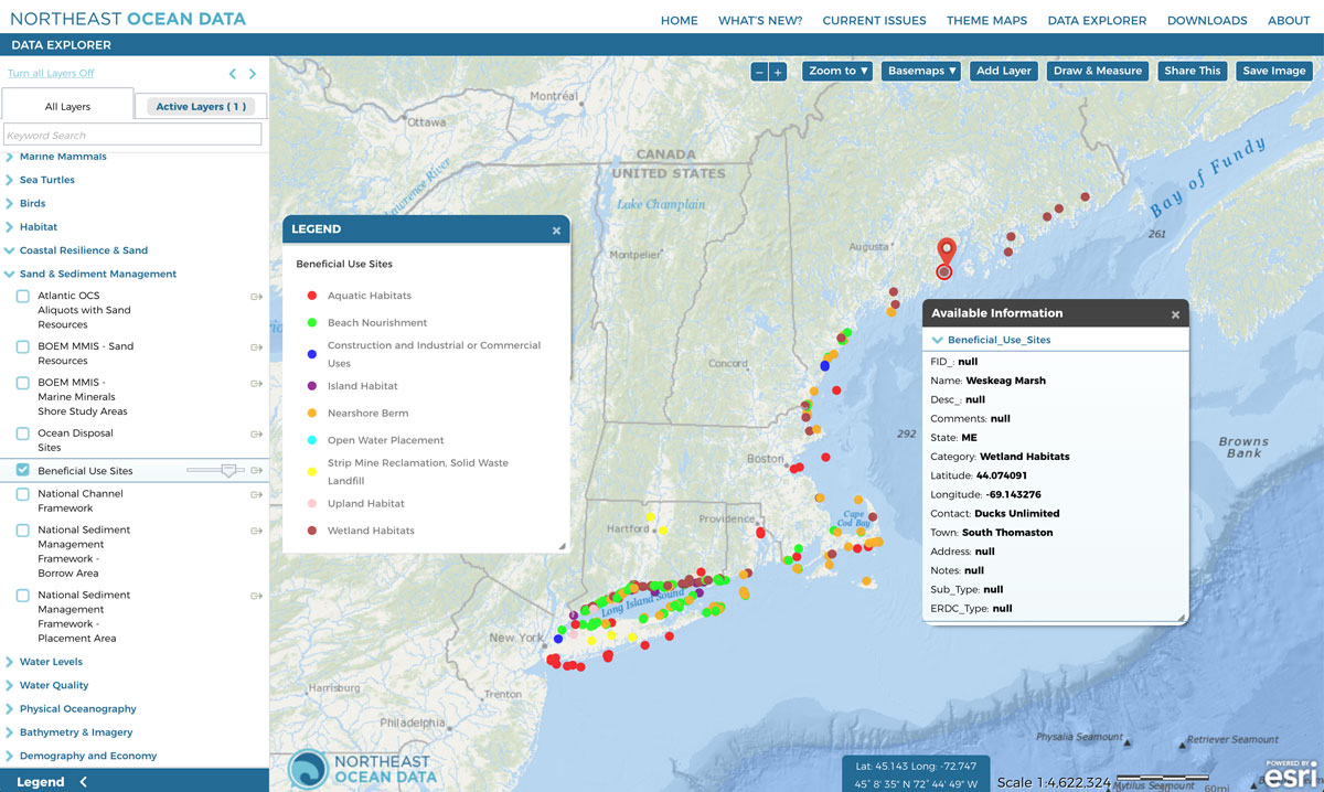
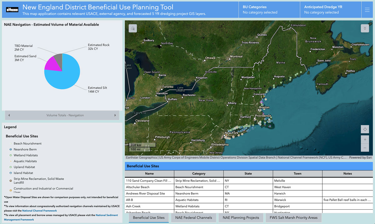
Beneficial Use Sites These data are being integrated into the Portal from the U.S. Army Corps of Engineers’ New England District Beneficial Use Planning Tool developed by the Disposal Area Monitoring System (DAMOS) Program. The data and Tool facilitate the identification of beneficial use opportunities for dredged material in New England. Portal users can activate a layer that displays the locations and types of beneficial uses of dredged material and visit the Tool to view summaries and statistics associated with beneficial use sites in the region.
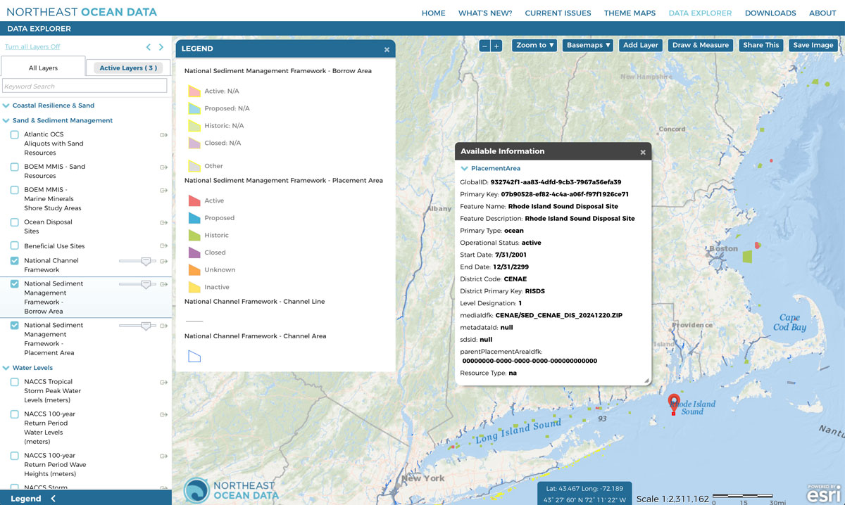
National Channel Framework
Derived from the Army Corps of Engineers Regional Sediment Management platform, the National Channel Framework is a database providing information about congressionally authorized navigation channels maintained by the U.S. Army Corps of Engineers. Details include reaches, channel areas, quarters, centerlines, and stationing.
National Sediment Management Framework Borrow Areas and Placement Areas Also derived from the Army Corps of Engineers Regional Sediment Management platform, these layers show the operational status of placement and borrow areas managed by the U.S. Army Corps of Engineers.