

Jul 15, 2026
The Northeast Ocean Data Portal has updated the “Fishing Footprints” dataset, provided by NOAA NMFS to include a new five-year time period: 2020-2024. The Portal previously included data from 2011-2015 and 2016-2020 that were available in the Commercial Fishing subtopic. This update adds the most recent time period for which data are available from NOAA NMFS, and it replaces the older time periods with updated layers. Over 60 new layers from 2020-2024 were added across gear type and fisheries management plan landings and revenue.
“NOAA NMFS Fishing Footprints” shows commercial fishing activity organized by gear type and Fishery Management Plan (FMP). Each gear type or FMP can be visualized as pounds of fish landed (landings) or the estimated value of those landings (revenue). With this update, users can now view data for three time periods: 2011-2015, 2016-2020, and 2020-2024.

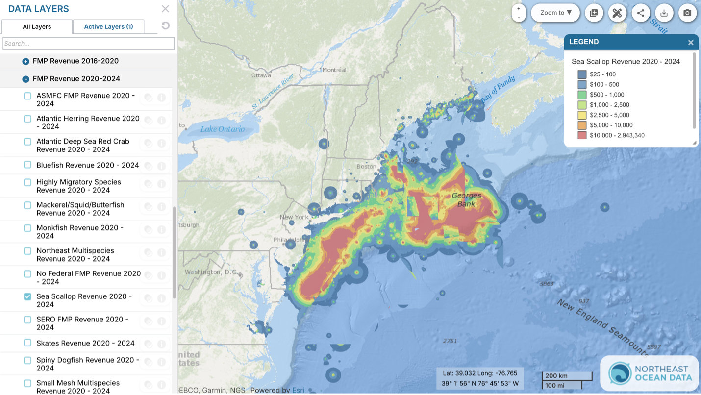
The 2020-2024 layers can be found by clicking on the “NOAA NMFS Fishing Footprints” dropdowns in the Commercial Fishing theme on Data Explorer and data can be downloaded aggregated or by data product on the Get Data page.
The Northeast Regional Ocean Council (NROC) and the Mid-Atlantic Regional Council on the Ocean (MARCO) continue to work closely with the commercial fishing industry, fishery managers, and NOAA NMFS, incorporating their input on methods, visualization, and documentation as new data becomes available. NROC and MARCO encourage users of these data to read all related documentation and access the metadata for additional information on processing and use.