


Bathymetry
Datasets and data products are compiled from various sources. Some of the data are also available to view in the Data Explorer within the Bathymetry and Imagery category in the Table of Contents.
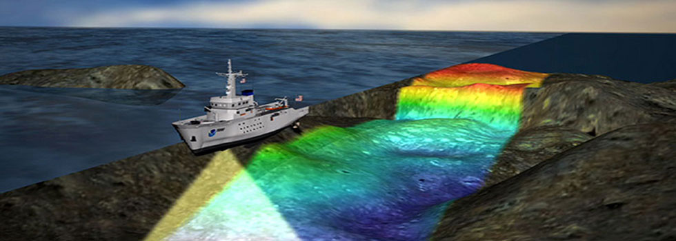
Bathymetry is the measurement of water depth and the shape of seafloor terrain. Just as topographic maps represent the three-dimensional features of dry land, bathymetric maps represent the land that lies underwater. (Image credit: NOAA)

Downloadable Bathymetry Datasets
Use the Data Explorer to find and download high-resolution bathymetry data from around the region hosted by the NOAA National Centers for Environmental Information (NCEI). Open this Data Explorer map and click any footprint to reveal the data download link in a popup window. For additional sources of externally hosted data, visit the Data Download page.

Local and Regional Data
Links to data and information from our partners related to bathymetry and seafloor characterization in the Northeast U.S.

National Data
Links to resources maintained by U.S. federal agencies regarding repositories of bathymetry and coastal topography for the nation.

Ongoing and Planned Surveys and US Mapping Coordination
Links to information about efforts to collect new bathymetry data and to coordinate mapping surveys.