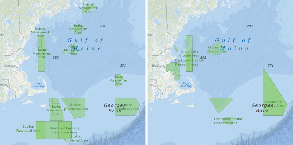
Screen captures showing some of the updated fishery management areas. Launch interactive map
Updated maps of fishery management areas are now available on the Northeast Ocean Data Portal.
These maps reflect the latest information from the NOAA National Marine Fisheries Service Greater Atlantic Regional Fisheries Office (GARFO), including some of the updated information associated with the New England Fishery Management Council’s Omnibus Essential Fish Habitat Amendment 2 (OHA2), such as revised habitat and groundfish management areas. The updated management areas data were provided by GARFO and are not a substitute for actual regulations. The layers provide a general depiction of a subset of applicable fishing regulations, restrictions and requirements, not the complete set of regulations. As a result, users are encouraged to read the applicable regulations in conjunction with use of these data.
The updated layers also include Sea Scallop Rotational Areas, Habitat Management Areas, the Nantucket Lightship Closed Area Exemption Areas, and Dedicated Habitat Research Areas.
Updated maps of fishery management areas are critical to several planning and management issues in the region being discussed using Portal tools and data, such as the New England Fishery Management Council’s Clam Dredge Framework, offshore wind energy planning and auction of commercial wind energy leases.
In the Data Explorer, updated Fishery Management Areas data can be overlaid with other human use data such as the NEFMC Draft Alternative Management Areas associated with the Clam Dredge Framework, wind energy planning areas, vessel traffic data, and fishing vessel activity data. Fishery Management Areas can also be overlaid with ecological data such as the sediment stability layer and deep sea coral habitat suitability.


