Whale watching near Cape Cod. (Photo credit: Matt McIntosh / NOAA)
Updated maps of commercial whale watching activity are now available to view in the Recreation theme map and in the Data Explorer.
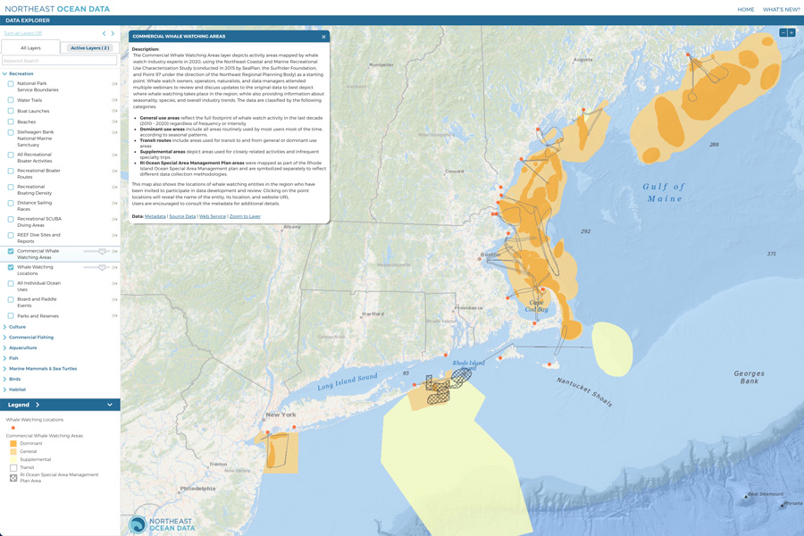
Over the past year, the Northeast Ocean Data Portal Working Group met with whale watch owners, operators, naturalists, and data managers to review and discuss updates to the Portal’s Commercial Whale Watching Areas dataset. The updated data reflect input received via virtual meetings and depicts places where commercial whale watching takes place in the region. The group also developed a layer that shows the locations of commercial whale watching entities that were invited to participate in the review of the data on the Portal. Clicking on the point locations will reveal the name of the entity, its location, and website URL.
Screenshot of updated Portal map showing commercial whale watching areas classified as general use areas (orange), dominant use areas (darker orange), and supplemental areas (yellow). Lines indicate transit routes for whale watching vessels. Red dots represent locations of commercial whale watching entities that were invited to participate in the review of the data on the Portal.
The updated data layer builds on the 2015 Characterization of Coastal and Marine Recreational Activity in the U.S. Northeast conducted by the Northeast Regional Ocean Council and Northeast Regional Planning Body with SeaPlan, the Surfrider Foundation, and Point97. That study resulted in the first regional map of commercial whale watching activity and showed general use areas, dominant use areas, transit routes, supplemental areas, and areas mapped via the Rhode Island Special Area Management Plan. The updated layer incorporates those results and adds areas of activity in the Gulf of Maine that were previously not included. The resulting map reflects the footprint of commercial whale watching activity in roughly the last decade.

Humpback whale and whale watching vessel at Stellwagen Bank National Marine Sanctuary. (Photo credit: Jeremy Winn)


