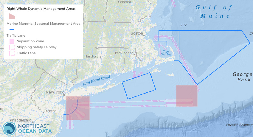
Dynamic Management Areas (DMAs) are voluntary slow-speed zones established by NOAA Fisheries based on visual sightings documenting the presence of three or more right whales within a discrete area. Mariners are encouraged to avoid these areas or reduce speeds to 10 knots or less while transiting through these areas. NOAA Fisheries announces DMAs to mariners through its customary maritime communication media.
Now, Portal users can view the current DMAs live in the Data Explorer as they are updated by NOAA Fisheries (approximately every hour). The DMAs layer can be overlaid with any other layer on the Portal, including Marine Mammal Seasonal Management Areas and marine Traffic Lanes.
The DMAs layer is located in the Marine Transportation – Navigation category in the Data Explorer. For more information visit the NOAA Fisheries page on Reducing Vessel Strikes to North Atlantic Right Whales and NOAA Fisheries’ map of recent right whale sightings.