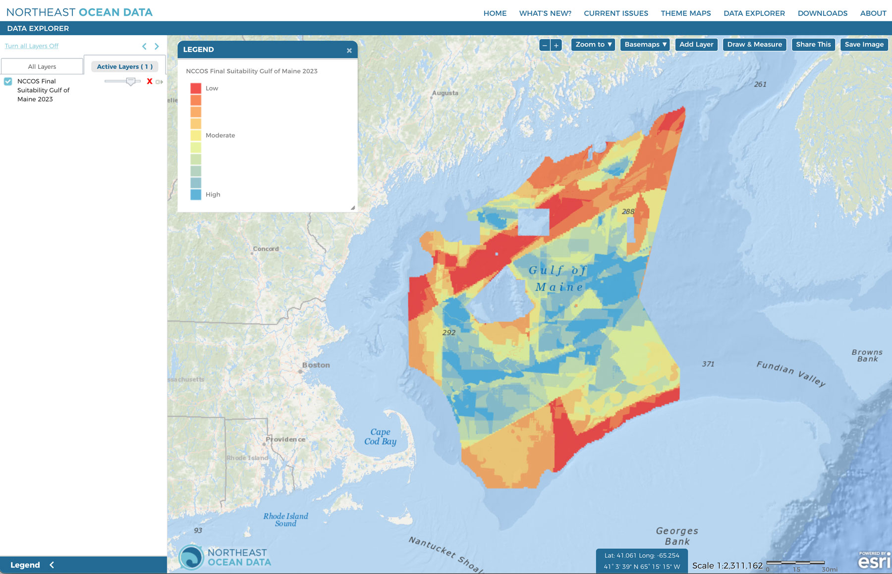
The Bureau of Ocean Energy Management (BOEM), with support from NOAA National Centers for Coastal Ocean Science (NCCOS), has conducted spatial analyses to determine optimal locations for draft Wind Energy Areas (WEAs) in the Gulf of Maine. The methods and results of the spatial analyses and modeling used to identify draft WEAs in the Gulf of Maine are summarized in a Draft NCCOS Report: A Wind Energy Area Siting Analysis for the Gulf of Maine Call Area (October 2023). The Gulf of Maine Draft WEA and Secondary Areas for Further Analysis were announced by BOEM on October 19, 2023. See the associated announcement of data availability on the Northeast Ocean Data Portal news page.
The Portal now contains five new layers that depict the relative suitability modeling results for BOEM’s Gulf of Maine Call Area. Users can find the layers in the Data Explorer under Energy & Infrastructure > Planning Areas:
- NCCOS Final Suitability Gulf of Maine 2023
- NCCOS Natural Resources Submodel Gulf of Maine 2023
- NCCOS Industry Submodel Gulf of Maine 2023
- NCCOS Wind Submodel Gulf of Maine 2023
- NCCOS Fisheries Submodel Gulf of Maine 2023
A comprehensive, authoritative spatial data inventory was developed including data layers relevant to national security, natural and cultural resources, industry and operations, fisheries, and wind logistics. Data were organized into categories (submodels) representing the major ocean sectors including natural and cultural resources, wind, fishing, and industry and operations. All data layers were assigned scores of relative compatibility allowing the calculation of an overall suitability score for each 10-acre grid cell of the study area. Using a cluster analysis, one draft WEA was identified representing the most suitable areas within the Call Area. Read the full Draft NCCOS Report for greater detail.
More information:
- BOEM Gulf of Maine page (includes latest information on public meetings)
- BOEM’s Request for Comment on Gulf of Maine Draft Wind Energy Area
- Draft NCCOS Report: A Wind Energy Area Siting Analysis for the Gulf of Maine Call Area (October 2023)


