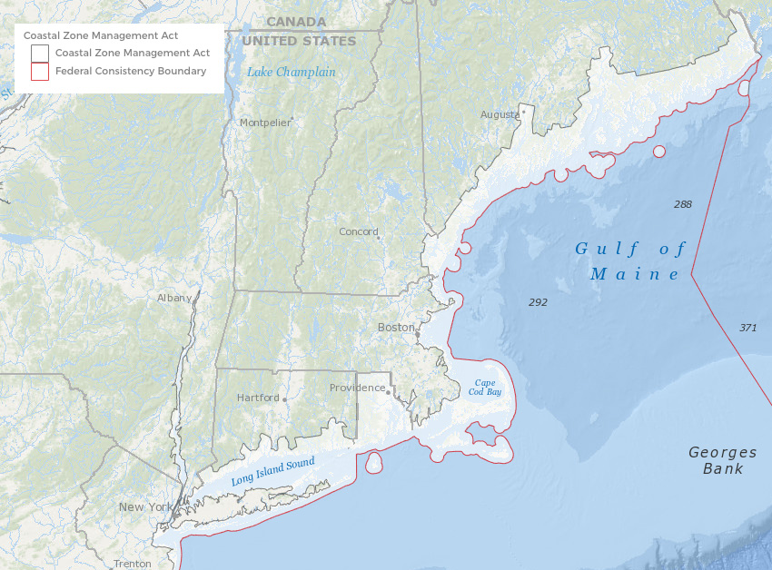
The Coastal Zone Management Act of 1972 (CZMA), administered by NOAA, provides for the management of the nation’s coastal resources, including the Great Lakes. The goal is to “preserve, protect, develop, and where possible, to restore or enhance the resources of the nation’s coastal zone.”
A newly added map layer on the Northeast Ocean Data Portal represents the extent of the nation’s coastal zone, as defined by the individual states and territories under the CZMA. The layer was developed by NOAA’s Office for Coastal Management and is hosted by MarineCadastre.gov. The zone generally extends seaward to the boundary of the Submerged Lands Act. The CZMA applies within the EEZ through the federal consistency provision (Sec. 307). In New England, state jurisdiction extends to 3 nautical miles. Areas of state-defined federal consistency review locations can be found on the Federal Consistency Geographic Location Descriptions map layer. The zone extends inland from the shorelines into coastal areas according to different provisions in each state’s Coastal Management Plan.
The maps on the Portal are for informational purposes only. State Coastal Management Program staff can provide additional information about each state’s CZMA boundary and considerations: