


Through its Resilient Shorelines Grant Program, the Northeast Regional Ocean Council (NROC) funded the development of a database and web services that provide streamlined access to high-resolution data on coastal storm and flood risk in the Northeast. Produced by a team from RPS ASA, the database includes projections for future climate scenarios and is a valuable resource to support planning and preparedness by state and local government.
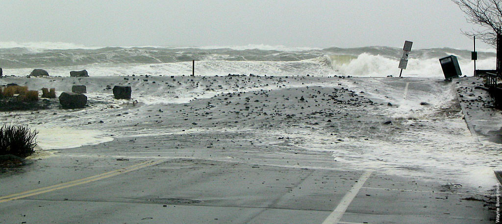
The North Atlantic Coast Comprehensive Study (NACCS) addresses coastal storm and flood risk in the North Atlantic region. Completed by the U.S. Army Corps of Engineers (USACE) in 2015 in response to Hurricane Sandy, the study was designed to help local communities better understand changing flood risks associated with climate change, and to provide tools to prepare for future flood risks that can be customized for any coastal watershed.
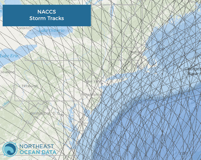
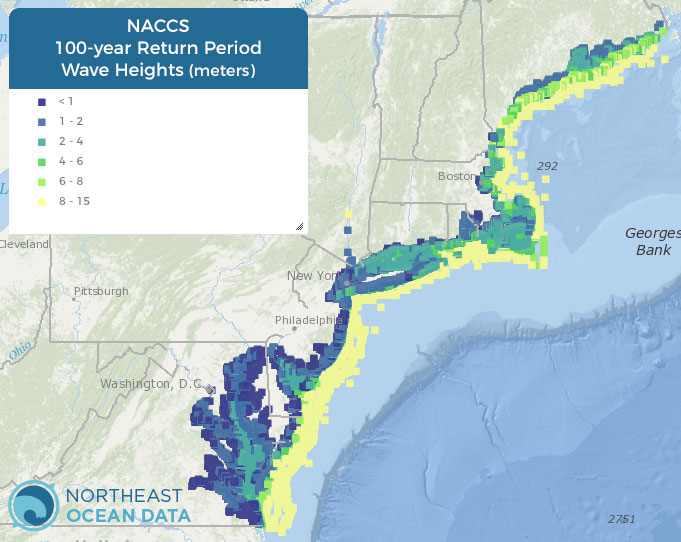
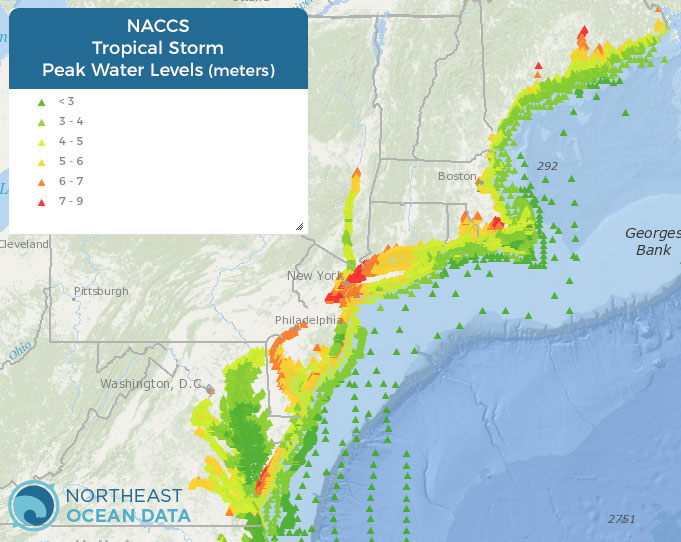
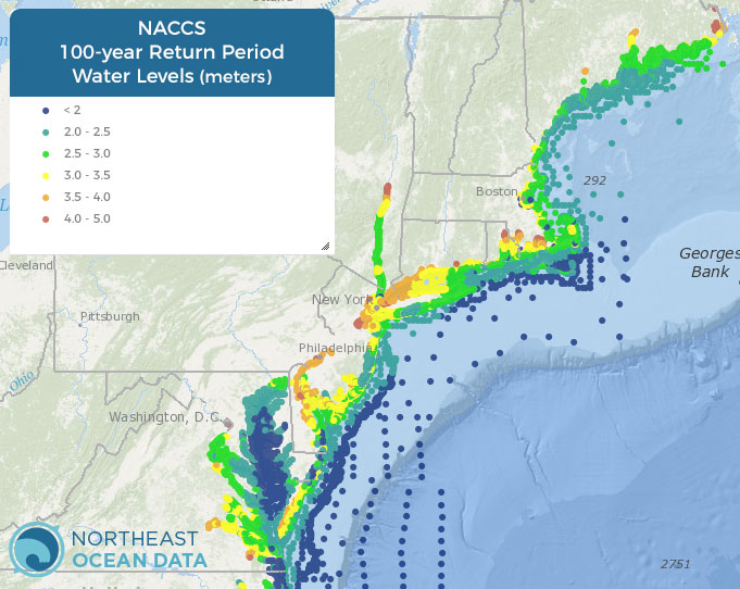
NROC worked with RPS to make a valuable subset of the NACCS data accessible to modelers and decision makers in the Northeast and Mid-Atlantic (funded by a USFWS North Atlantic Landscape Conservation Cooperative (LCC) and NOAA’s Office for Coastal Management). Several layers from NACCS are now available in the Data Explorer under Physical Oceanography. The layers include the hypothetical modeled storm tracks used to develop the estimates of flood risk, as well as Tropical Storm Peak Water Levels, 100-year Return Period Water Levels, and 100-year Return Period Wave Heights.
As part of NACCS, the USACE developed several products, planning tools, and models to assist decision makers in applying the Coastal Storm Risk Management Framework. Those efforts included state-of-the-art atmospheric, wave, and storm surge modeling to characterize storm hazards in the North Atlantic region, including coastal areas of all NROC member states.
To read more about NACCS and to access the full database of approximately 19,000 points and other spatial data products, visit the NACCS page on the NROC website. The final database and API (https://docs.naccs.apiary.io/#) are hosted by the Northeastern Regional Association of Coastal Ocean Observing Systems (NERACOOS). Web services hosted by Northeast Ocean Data allow ArcGIS users to access the NACCS data.
Two virtual workshops offered on NACCS
The first workshop provided a general overview of the data and its applicability, while the second workshop will be focused on technical usability aspects for end users.
- Session 1 – NACCS overview: Informing coastal decisions in the Northeast
October 21, 2020, Wednesday | 10am – 11am Eastern Time - Session 2 – NACCS technical session: Understanding what’s under the hood Session 2 will be offered twice to provide flexibility in scheduling:
October 27, 2020, Tuesday | 10am – 11:30am Eastern Time
October 29, 2020, Thursday | 10am – 11:30am Eastern Time
Register for Session 2
Both workshops are meant to familiarize a variety of decision makers, coastal planners, and engineers with the study and a few key derived data products.
For More Information:
- USACE North Atlantic Coast Comprehensive Study Website
- USACE NACCS Main Report
- USACE Report – NACCS Coastal Storm Model Simulations: Waves and Water Levels
- Presentation by RPS ASA at NROC Meeting (February 2017)
- Geodatabase object relationship diagram
Project Participants:
- Connecticut Department of Energy and Environmental Protection
- Maine Coastal Program
- Maine Geological Survey
- Massachusetts Office of Coastal Zone Management
- New Hampshire Department of Environmental Services
- Northeastern Regional Association of Coastal Ocean Observing Systems
- Rhode Island Coastal Resources Management Council
- University of New Hampshire
