


Case Study
Supporting Ocean Planning in the State of Connecticut

The Long Island Sound Blue Plan identifies Ecologically Significant Areas (ESAs) and Significant Human Use Areas (SHUAs) in the Sound based in part on data from the Northeast Ocean Data Portal. On the map, warmer colors indicate more overlapping ESAs.
“The Northeast Ocean Data Portal represents a huge savings of time and effort from the standpoint of having data and information already publicly accessible, documented, and displayed. Without it, we would have likely had to dedicate considerable resources to try and develop similar capabilities in order to effectively engage stakeholders and experts for review and comment.”
Kevin O’Brien
Connecticut Dept. of Energy and Environmental Protection
Northeast Ocean Data Portal User:
Connecticut Dept. of Energy and Environmental Protection
In Consultation with:
Long Island Sound Blue Plan Advisory Committee
University of Connecticut
Objective:
To incorporate existing datasets from the Northeast Ocean Data Portal into Connecticut’s Long Island Sound Blue Plan, leveraging regional data layers and related stakeholder engagement.
The Long Island Sound Blue Plan is a comprehensive framework to guide development and permitting of the Sound’s waters and submerged lands. The Plan seeks to sustain traditional uses of the Sound, support compatibility of new uses, and protect the Sound’s ecosystems and resources through science-based decision-making.
The Northeast Ocean Data Portal helped facilitate development of the Blue Plan by providing dozens of datasets used to characterize the ecosystem and human uses of the Sound. By incorporating these data layers into its ocean planning process, the State of Connecticut leveraged several years of data acquisition, map development, and stakeholder input, resulting in significant savings in time, resources, and effort.
Blue Plan Process
Step One
Compile data on natural resources and human uses from sources including the Northeast Ocean Data Portal
Long Island Sound Resource and Use Inventory
Step Two
Engage stakeholders to map resources and current and potential uses to minimize conflict
Long Island Sound Blue Plan
The first step in the Blue Plan development process was the compilation of the Long Island Sound Resource and Use Inventory. The Connecticut Department of Energy and Environment (CT DEEP) with partners from the University of Connecticut, Connecticut Sea Grant, and The Nature Conservancy worked with scientists and people who work, live, and recreate on Long Island Sound to produce the Inventory. They sought out the best available information and data on the Sound’s plants, animals, habitats, and ecologically significant areas, and on human uses such as boating and fishing, shipping corridors, aquaculture sites, and energy facilities. The Blue Plan states that the Northeast Ocean Data Portal “is a very useful compilation of resource, habitat, and human use data for the entire Northeast region, including Long Island Sound, and is frequently referenced in the Inventory.”
Data from the Portal and other sources provided the foundation for maps of designated Ecologically Significant Areas and Significant Human Use Areas used in developing the Blue Plan. The data are also incorporated into the Blue Plan Map Viewer.
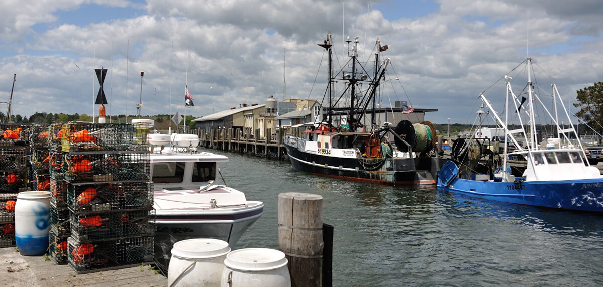
The State of Connecticut developed the Long Island Sound Blue Plan to protect the Sound’s natural resources and traditional uses such as commercial fishing, and to support compatibility of new uses.

The Blue Plan development process included extensive stakeholder engagement, such as this meeting of the Connecticut Harbor Management Association, where Blue Plan Advisory Committee member Nathan Frohling presented a Blue Plan overview. Photo credit: Emily Hall
Datasets from the Northeast Ocean Data Portal used in development of the Long Island Sound Blue Plan:
Marine Life and Habitat
Artificial Reefs
Cetacean Abundance
Fish and Invertebrate Biomass
National Security
Naval Undersea Warfare Center Testing Range
Commercial Vessel Traffic
All Vessel Transit Counts
Cargo Vessel Density
Tanker Vessel Density
Navigation
Cable and Pipeline Areas
Ocean Disposal Sites
Submarine Cables
Wrecks and Obstructions
Recreation
Boat Launches
Distance Sailing Races
Pleasure Craft/Sailing Vessel Density
Recreational Boating Activities
Recreational Boating Routes and Density
SCUBA Diving Areas
Shore-based Ocean Uses
Water Trails
Wildlife/Sightseeing
Maps of Significant Human Use Areas
Examples of maps that were used to identify Significant Human Use Areas (SHUAs) for the Long Island Sound Blue Plan. Several of SHUA maps were developed using data available on the Northeast Ocean Data Portal.
Presentation about Long Island Sound Blue Plan
This video is a recording of a presentation by David Blatt (Connecticut DEEP) and Christian Fox (The Nature Conservancy) as part of a webinar on May 28, 2020, hosted by the Northeast Regional Ocean Council (NROC) Ocean Planning Committee.
Related Interactive Maps:
Marine life
Recreation
Marine transportation and navigation
For More Information:
Long Island Sound Blue Plan Website
Long Island Sound Blue Plan Resource and Use Inventory
Blue Plan Map Viewer
Blue Plan Webinars and Map Books
Blue Plan Advisory Committee
Updated: September 2020