


EXTERNAL DATA SOURCES
Along with Northeast Ocean Data, other sources of maps and data are available for ocean planning in the region. This page provides a directory of select sources. Northeast Ocean Data is not responsible for data integrity or operability of the resources listed on this page.
Click on any sub-title below (for example, Maps and Tools or Other Data Sources) to see available data sources
Maps and Tools
REGIONAL
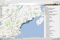
 The Northeastern Regional Association of Coastal and Ocean Observing Systems (NERACOOS) provides real-time maps, forecasts, and historical data on ocean conditions.
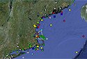
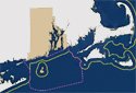
 The Environmental Response Management Application (ERMA) is a web-based GIS tool for emergency responders and environmental resource managers. ERMA integrates real-time and static datasets into a single interactive map.
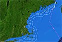
 The U.S. Atlantic Coast and Eastern Region Internet Map Server web page of the U.S. Geological Survey is a gateway to maps and data on high-resolution seafloor mapping, shoreline change, sediments, and other features.
STATE
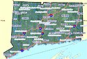 Connecticut Environmental Conditions Online provides simple and advanced interactive map viewers with many types of data related to coastal resource management, along with aerial photographs.
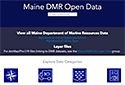 Maine Department of Marine Resources Open Data provides centralized access to interactive maps and data on Maine’s marine life, fisheries, aquaculture, and more.
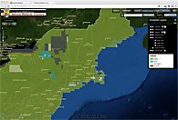
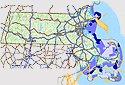 The Massachusetts Ocean Resources Information System (MORIS) is an interactive map that can be used to find and display spatial data pertaining to the Massachusetts coastal zone.
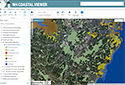 The New Hampshire Coastal Viewer is an online mapping tool with datasets related to coastal resources and hazards in the state’s 42 coastal watershed communities.
 The New York Geographic Information Gateway provides public access to data, interactive maps, real-time information, and expert knowledge relevant to the Office of Planning and Development’s activities throughout New York State.
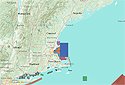
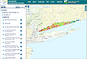
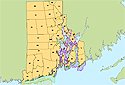
 The Rhode Island Ocean Special Area Management Program map viewer has satellite images, nautical charts, and data on ocean uses, environmental characteristics, and administrative boundaries.
 The Rhode Island Department of Environmental Management provides interactive maps of environmental resources, aquaculture areas, shellfish harvest restrictions, and more.
NATIONAL
 The Marine Cadastre is a joint initiative of the Bureau of Ocean Energy Management (BOEM) and the National Oceanic and Atmospheric Administration (NOAA) to provide authoritative data to meet the needs of the offshore energy and marine planning communities.
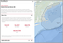 The OceanReports tool is a web-based, report-centric tool that provides coastal and ocean planners with a high-level analysis for their custom-drawn area of interest, developed jointly by the Bureau of Ocean Energy Management (BOEM) and the National Oceanic and Atmospheric Administration (NOAA).
 NOAA’s Digital Coast provides access to dozens of tools for data analysis, data visualization, and simulation in support of ocean and coastal planning.
 Ocean.Data.Gov is the National Ocean Council’s portal with a wide range of data, information, and tools to support people engaged in ocean and coastal planning.
 The Wetlands Mapper displays wetland habitat data from the U.S. Fish and Wildlife Service.
Web Mapping Services
STATE
FEDERAL
- Bureau of Ocean Energy Management (BOEM)
- EPA STORET
- EPA Watershed Assessment, Tracking & Environmental Results
- MarineCadastre.gov
- NOAA Electronic Navigational Charts
- NOAA NowCOAST
- NOAA National Centers for Environmental Information
- USGS Coastal and Marine Geology Program
- USGS National Water Information System
- U.S. Fish and Wildlife National Wetlands Inventory
NON-GOVERNMENT
Other Data Resources
STATE
- Connecticut Department of Environmental Protection
- Maine Office of GIS
- Maine Commercial Fisheries Landings Data
- Maine Department of Environmental Protection GIS Unit
- Massachusetts Division of Marine Fisheries (MIS & Fisheries Statistics)
- New Hampshire Geographically Referenced Analysis and Information Transfer System
- New York State GIS Clearinghouse
- Rhode Island Geographic Information System
- Rhode Island Ocean Special Area Management Plan
FEDERAL
- Bureau of Ocean Energy Management
- Bureau of Safety and Environmental Enforcement
- EPA Regulated Facilities (Facility Registry System)
- NOAA Integrated Ocean Observing System Catalog
- NOAA National Marine Fisheries Service
- NOAA National Marine Fisheries Service: InPort – Data and Tools Repository
- U.S. Army Corps of Engineers – Spatial Data Branch
- U.S. Army Corps of Engineers – Navigation Data Center
- U.S. Geological Survey – Internet Map Server and GIS Data
- U.S. Geological Survey – Data Archives
- U.S. Fish and Wildlife Service
- U.S. Fish and Wildlife Service – Migratory Bird Data Center
NON-GOVERNMENT
- Mid-Atlantic Regional Council on the Ocean Data Portal
- The Nature Conservancy (Northwest Atlantic Marine Ecoregional Assessment)
- University of Connecticut Map and Geographic Information Center
- University of Rhode Island Environmental Data Center
- National Ocean Economics Program
- Ocean Biogeographic Information System
